 on the road was the lack of systematic packing of our gear. Ron got to the point of "throw this junk in and let's get out of here".
 Again we relied on the Navigator and got a tour of the backroads and small towns of South Carolina. This made things go a little slower than we wanted because of what seemed like hundreds of 35 MPH zones. We overcame these issues and rolled into Ron's sister's house about 8:00 PM Monday night. We spent most of the week "just" visiting with Ron's sisters and Roberta's family. We visited her oldest son and wife at their new log home on the Edisto River
 and got a chance to visit an Edisto River fish camp. The Edisto is beautiful, southern river that meanders throught cypress groves and has been known to yield 8 pound
  large mouth bass and 40-50 pound catfish. This is a real fishing area and Roberta and her family love to fish. On Friday night we got a chance to try some real southern comfort food as Ron's niece Bonnie took us all out to Dukes BBQ for dinner.
 Friday during the day we traveled Beaufort South Carolina. On our way to Beaufort we stopped
Pon Pon Chapel, one of the areas on the Historic registry. 

Following is a clip from Palmetto History.org:
Established in 1725 by an Act of the General Assembly, Pon Pon Chapel of Ease was one of two churches serving St. Bartholomew’s Parish after the Yemassee War (1715) aborted plans for a parish church. The chapel site was located on Parker’s Ferry Road, the busy stagecoach thoroughfare that connected Charleston and Savannah. In 1754, a brick chapel was erected to replace the earlier wooden structure. This brick chapel burned in ca.1801, causing Pon Pon Chapel to become subsequently known as the Burnt Church. The chapel was rebuilt between 1819 and 1822, and was in use until 1832 when it was again reduced to ruins. The façade of Pon Pon Chapel had a central, rounded arched entrance flanked by rounded arched windows on either side, all constructed in a brickwork pattern of one stretcher alternating with two headers. The two round windows in the façade’s upper level utilized the same brickwork pattern. The walls were constructed in Flemish bond. The chapel’s historical significance is due in part to Rev. John Wesley preaching two sermons here on April 24, 1737 and for its burial ground that contains the remains of Congressmen Aedanus Burke and O’Brien Smith, in addition to numerous local leaders. Listed in the National Register January 5, 1972.
It is still amazing to us to see old the history of our country truly is once we get out of Oregon.
In addition to being within a stones throw of one of our Marine air bases,  it is also just a few miles away from the training ground of America's finest, the Devil Dogs of the USMC. Parris Island is the east coast camp where our young Marines become MEN. Beaufort is also a very scenic old town that has had many movies shot in the area. The Great Santini, Prince of Tides and Forrest Gump are just three of the better known movies that have been filmed there. We also went out to Ladys and Hunters Islands. Hunters Island has the only public accessible lighthouse in South Carolina and is in a beautiful setting among the Palmettos. It is, like most light houses, only a short walk from the Atlantic Ocean. The problem with the day that we were there was, like the rest of the country, it was cold. We walked out onto the beach, took three pictures and said let's get the heck out of here.
it is also just a few miles away from the training ground of America's finest, the Devil Dogs of the USMC. Parris Island is the east coast camp where our young Marines become MEN. Beaufort is also a very scenic old town that has had many movies shot in the area. The Great Santini, Prince of Tides and Forrest Gump are just three of the better known movies that have been filmed there. We also went out to Ladys and Hunters Islands. Hunters Island has the only public accessible lighthouse in South Carolina and is in a beautiful setting among the Palmettos. It is, like most light houses, only a short walk from the Atlantic Ocean. The problem with the day that we were there was, like the rest of the country, it was cold. We walked out onto the beach, took three pictures and said let's get the heck out of here. Coming soon St Augustine.


 this is a site where history should be felt and not seen. The cemetery was like seemingly all cemeteries in the Southeast. All the cemeteries we saw were not only neatly manicured, but all the gravesites had what looked like fresh flowers on them, something that is not done in our area on Memorial Day. It is a part of the “yes sir, no maam” respect that the southeast is founded upon.
 In the middle of the tour we stopped at the Cairo museum. The Cairo (pronounced like Karo syrup not the town in Egypt) was an ironclad ship that was one of seven that the Union built to try to wrest control of the Mississippi River form the Confederacy. It was sunk in the Yazoo River by rebel forces using what were called remote controlled torpedoes. We now call them mines. This was not the wireless remote that we channel surface with, but rather a wired device that a soldier hiding in the brush would use to detonate the torpedo. During the 1960s an engineering using a compass found the gunboat sunk in the mud in the riverbed. After several tries it was raised in 1964 and partially restored.

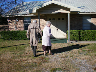 Connie’s uncle had retired from the pulpit, but was asked to serve as “interim” pastor at this church. They have to travel 28 miles one way to the church and have a morning and evening service on Sunday, and a Wednesday evening Bible study. On Sundays they stay in the little trailer next to the church and rest to prepare for the evening service. We also got to attend Sunday school with Brother Freddy leading us in a study of Joseph in Genesis 39-41, a good lesson in fleeing from temptation rather than standing, thinking that we are brave enough, and strong enough, to withstand. He also brought up something about tithing that I had never thought about. God asks us for our first fruits and when he says that he means from us also, not just our checkbooks. Who among us spends 2.4 hours minimum per day doing the things of the Lord?
 We could not leave town without driving around once more and just look at the buildings

 in this town. There is a mix of the old and the new, with old Victorian style homes, as well as the antebellum style Plantation homes. There also is a street called The Strand where next weekend they will have a Mardi Gras parade. I am so glad we got there a week early.
 This ride is a 20 minute ride to Port Bolivar on the peninsula NE of Galveston, over Galveston Bay. A note here, we did not choose the route, but the navigator did. We were not disappointed to miss bumper to bumper traffic through the road construction in Houston. This ride takes you through low-country that has a good share of the houses built on stilt foundations.
 Since this is the Gulf, they have some inclement weather that blows in now and then, and when the tide surges over the seawalls they are somewhat prepared. Again we got to see the back roads of Texas and the different ways that people cope with their environments.


 It apparently worked because we got one of the last two rooms left yesterday, and that for only one night. There is a National cheerleading competition and town and our hotel is full of giggling teenage girls. After being semi-empty nesters it sounded kind of nice to have kids sround again. We knew we were officially in the south when we asked when of them a question and she replied, "yes sir" in a beautiful southern drawl.


 On the way is an interesting little town known as Roswell, New Mexico. Even the McDonalds in town has a UFO theme to it. This is the one time that the Navigator let us down. We were looking for the post office in town, and apparently they had built a new one, and the old one is now the transit office. After driving in circles around town we finally gave up and took off. Never did find that post office. The farther east and south
 you travel in New Mexico, and on into Texas the more oil derricks you see. By the time we stopped for lunch in Denver City Texas we had even run across the world (and liberal nut-case) famous Haliburton. It reminded me how much I would really
 like to have a Bush-Cheney 08 sticker for driving around back in Portland.
  Ca to visit Connie's dad. We did meet up with Henry and Maryanne yesterday and had a wonderful 6 hours with them , including lunch and a trip back to their place. Death Valley is an amazingly beautiful place. For Creationists like us it is unbelievable
 to see what the spoken word of God has created.
  The mountains surrounding Death Valley are just breathtaking!
 I-40 through Williams and Flagstaff, and went up through a pass that was higher than anything in Oregon. Just like all of Oregon is not like Portland, so not all of Arizona is
  not like Phoenix/Tucson. We stopped in Flagstaff for lunch at the Galaxy diner on old Route 66. It is a real throwback to the 60s. My right foot is in love with Nevada, Arizona and New Mexico so far. The 75 mph freeway signs are wonderful and we passed state troopers on the side of the road while we were doing almost 85, and not a look. That may change a bit as we start heading south and east. Traveling across Louisiana, Mississippi, Alabama and Georgia might make us a little more cautious.


